
Walk 7 - Shaftoe Crags - Moderate Route
Distance: 6.5 miles (10.5 km)
Maps: Explorer OL42
Walking time: 3 hours
Start and Finish point: Westwood car park, Bolam Lake Country Park, near Belsay on the Belsay to Scots Gap road (Nz 079817). This is a pay and display car park.
DOWNLOAD the free self led walking guide for Shaftoe Crags here
Summary
This lovely walk starts off and finishes at the 100-acre beauty spot of Bolam Lake.
After skirting the lake for a short while you pass through some traditional pastoral fields for about half the distance.
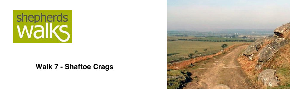
You climb slightly to reach East Shaftoe Grange, with its walled garden. You climb very gradually until you reach the moorland section of the walk, with some breathtaking views of the surrounding area, which has involved very little effort.
You descend back down to the fields and amble your way down to a track that returns you to Bolam Lake.
Route Details
Walk back towards the entrance you drove in through and just before you reach the road turn left down a path, which runs parallel to the main road. Continue on and you have the road on your right and Bolam Lake on your left.
Bolam Lake is artificial and was designed by Dobson in 1818 for the Hon. Charles Beresford. It is a popular place to come and feed the wildfowl.
At the fork in the track bear right and you reach Lowhouse Wood car park. Pass through the car park and head towards the entrance/ exit used by the cars, which is away to your left.
Upon reaching the road turn right along it. Follow the road for a short distance until you reach a junction. At this point turn left (signposted Belsay 2, Newcastle 16) and continue on for around 50 yards, and pass through the ‘White Gate’ gate on your right (Public footpath Harnham 1 mile).
Pass diagonally across the paddock to the stile in the corner. Cross it and walk in the same direction through the next field.
Cross the wooden bridge and continue on to the next stile, following the fence on your right. Leave the field using the ladder stile into the newly planted wood and follow the well-trodden track.
Bear right at the marker post and cross the footbridge. Pass through the gate and cross the small paddock to the stile leading onto the track, and turn right along it (PF marker).
Follow the track through the paddock (watch out for over friendly horses!) and and after a little while you pass through the gate on the right (PB Sandyford leading to PF East Shaftoe Hall). Cross the ford, or if the water level is too high there is a footbridge to the left.
Walk across the open field aiming for the buildings ahead of you (Sandyford Farm).
The field you are crossing gives you a good idea what ‘unimproved’ pasture is like. It has not been ploughed and improved with sowing new grass seeds and applying fertilisers and sprays. Therefore the pasture is far less productive, but it gives an ideal habitation for wildlife.
Eventually you will reach a tarmac road, turn right along it. When you reach a fork bear left and continue on with the fence on your left. You should pass in front of Sandyford Farm, and pass through a gate (usually left open).
Continue along the road, crossing the How burn on a road bridge. Go through the metal gate before passing a bungalow on your right. From here it is possible to see the main road ahead of you. About two-thirds along the tarmac track turn right, along the field divide (PF sign East Shaftoe Hall ¾, Middleton Bank Top 2).
Walk along this field divide, aiming for the farm buildings. To the left of the farmhouse you can see Shaftoe Crags.
Continue on and go over the stile before crossing the footbridge. Follow the footpath as it rises up the middle of the field heading for the buildings, which have just dropped out of site. Pass through the wooden gate situated in a wall, before you rise up to the house on a track.
When you reach the large house (East Shaftoe Hall) turn left and continue along the track with the walled garden to your left.
A late 13th or 14th century tower forms the earliest part of East Shaftoe Hall. It stands at the west end of a 16th century house which has 17th and 18th century alterations. In the 17th century it was altered to become a more conventional house, and in the 18th century quite drastic alterations were made. These entailed reducing the height in some areas and heightening others and replacing all the mullioned windows with sash windows. The hall is now a grade 1 listed building.
As you continue on you pass a row of cottages on your right.
Continue to climb and pass through a metal gate on to the moorland. You ascend gradually to the crags on a cobbled road. This would have been built to keep the estate workers busy during the wintertime. It certainly makes it good underfoot!
You will eventually come to the crags on your left-hand side. You have to leave the main track to access them, just after the horse jump on your left.
From here you can enjoy a fine view as you look down on the A696 winding its way from Newcastle up to Edinburgh. Also Wallington Hall is very obvious to the Northwest.
Across the road to the east you can see Kirkheaton wind farm. This wind farm is owned by Kirkheaton Wind Farms, a joint venture between Northern Electric Generation Ltd and Hexham Wind Ltd. The Wind Farm consists of 3 x 600 kilowatt (kW) wind turbines. With a maximum capacity of 1.8 megawatts (MW) it provides enough electricity for almost 1,100 households. Each turbine has a tower height of 45m and blade diameter of 42m.
There is a triangulation point on the hill behind you. This is at a height of just over 700 feet above sea level.
Continue back to the track and along it, so that the ground is rising up to your right. After a short while the track becomes a footpath and as you pass down to Shaftoe Grange, with its prominent white gate. Bear right off the main path, so that you pass to the right of it.
Follow the wall keeping to the right of it. In front of you in the distance is Middleton Hall with Cambo Church and Wallington Hall away to your left.
Hodgson, who was a Northumbrian historian and vicar of Hartburn built holy Trinity Church, in Cambo in 1842. The church has a simple aisle-less naive with whitewashed walls and pine pews.
As you continue follow the path as it turns through 90 degrees as you reach the corner and continue on, still following the wall on your left as it rises up, passing a stile on your left, towards and through Salters Nick, which is like a mini canyon.
After the Nick pass through a gate (public footpath marker on it) and continue to follow the wall on your left.
While on this moor land keep your eyes open for birds of prey. There are a number of kestrels in the area that can be seen hovering ready to swoop on their prey.
You soon pass from the moor land back on to a meadow, with a wood on your right-hand side.
The stone wall on your left has been built to a far higher standard than many other walls that you find. The dressed stone often means it would have been an estate boundary, rather than the rough ‘undressed’ stone that would have been used for the internal walls within the estate.
Eventually you reach a rough road, bear left along it and cross the cattle grid, heading down to Bolam West Houses.
Follow this track down, passing some cottages on your left-hand side until you reach the road. Turn right along it, and follow the road for a short distance, until you reach the corner of Bolam Lake Country Park on your left. Turn into the Country Park here, next to the road sign pointing in the opposite direction saying ‘Harnham’.
After entering the Country Park turn right immediately and follow the track that runs parallel to the road. Eventually you will reach the car park.
Revised March 2005