
Walk 6 - Rothbury Town Walk - Easy Route
Walking time: Approximately 1 hours
Start and Finish point: Rothbury. Cowhaugh car park (Nu 057015) situated next to river Coquet. If you are entering Rothbury on the B6342 from the South (Cambo direction), turn left just before you cross the bridge as you approach Rothbury village centre.
Children: I researched this walk with my daughter asleep in her pram. Therefore I would say it is suitable for children of all ages. The route involves crossing stepping stones, which may be a problem with a pram or younger children. There is however, an alternative route by using the road bridge a little way down river.
DOWNLOAD the self led walking guide around Rothbury from here.
Walk Summary
This is a short town walk around Rothbury. It takes you past points of local interest and gives you a small amount of history about the town.
It is more a walk for the family rather than the serious walker who is aiming for something more challenging.
Route Details
The flat land to the west of the car park (up river), which is now a golf course was a steeplechase course. The first official meeting was held on April 28th, 1762, and the final one was on April 10th, 1965.
They would place a removable bridge spanning the river Coquet especially for race days. The horses mainly travelled to Rothbury by railway and then were stabled all over the area.
The Duke of Northumberland was the steward at the last meeting, when the races had to come to an end due to the withdrawal of the Horserace Betting Levy Board’s financial contribution. A dozen other small meetings were closed at the same time for the same reason.
Leave the car park by returning to the road you drove in on. Turn left, and walk up towards the bridge, with the river on your left.
Originally the bridge had three arches, but the nearest arch to you was added in 1759 as the river moved Southwards. The bridge was originally constructed in the fifteenth century.
Do not cross the bridge but cross the road and bear right (road sign saying Cambo 13, Hexham 32).
After a short while you reach a steep road going down to your left, opposite the Coquet Vale Hotel. You turn left down this.
Before you turn down it you can see an industrial estate just across the stock loading pens in front of you. These are on the site of the old Rothbury station.
The opening of the railway in October 1870 certainly made Rothbury prosper. The town was substantially rebuilt in the years following 1870, with many new houses and public buildings being built. The line ended on a turntable. There was a large goods yard and the station handled a lot of livestock, as it was situated right next to the market. Under Dr Beeching’s axe for non-profitable branch lines, Rothbury passenger service ended in September 1952.
Go down the steep hill, which runs parallel to the stock runs for the livestock mart. As the mart is situated down by the river, all the stock is loaded and unloaded at the top of the hill and run down to the holding pens. The mart was started in 1871. This was at no coincidence one year after the railway arrived. This shows what impact the coming of the railway had on Rothbury.
Continue past the mart buildings and the road turns into a path for a short while until it reaches the stepping stones.
Cross the twenty stepping stones (if the river is not too high!), and turn left.
Bear left again along ‘Riverside’. This road runs up parallel to the river. Just before the bridge go up to the right, going onto the main road and turn right along it.
Walk past the Railway Hotel on your right and take note of the Jubilee Hall on your left as you approach the junction.
This was originally built as a reading room and library. It was later extended to celebrate Queen Victoria’s Diamond Jubilee.
As you reach the junction cross the road in front of you and turn left.
Take a quick look at The Queens Head public house. Raise your eyes up the outside wall, and you can see the ‘Queens Head’.
You then pass ‘Barclays Bank’ which was originally the North-Eastern Bank when it was first built.
Carry on up the street passing the Otterburn Mill shop, which was built in 1960 and continue up Prospect Terrace.
You pass the Lloyds Bank building on your right. What a grand building to be built in Rothbury in 1869. There were some splendid buildings built in Rothbury in the 19th century. These stand amidst much older properties.
A lot of the older buildings in Rothbury were originally thatched with heather. This as you can imagine was a great fire risk. Rothbury burnt down on no less than three occasions. The first of these great fires occurred in 1738, then in 1782 and again in 1785. This may have been one of the reasons Rothbury village was presented with a fire engine in 1788. This was kept in the church porch. In 1870, the year that the railway arrived, Welsh slates were brought in to re-roof the village and most of the buildings still have blue slate roofs.
You continue up the street, with the trees on your left. These were planted in the late 19th century. You soon pass the Congregational Church on your right, which was erected in 1842.
At the top end of the high street you eventually reach St Agnes Catholic Church, cross over the road in front of Rothbury House. This was originally opened in 1789 as the County Hotel to cater for the visitors. Now it is owned and managed as a convalescent home for the Royal Air Forces Association.
Turn left after crossing the road and come back down the main street.
You pass the old Coquetdale Cottage Hospital, on your right. This building was a gift to the village from the Dawson family to Dr Fredrick Barrow. He made the former boarding house into a hospital. When the National Health Service took over in 1948 the valley raised a large sum of money to bring it up to the necessary standards. The hospital closed in 2006 and is now private apartments. The new, modern built hospital is now on the opposite side of the river, overlooking the golf course.
As you continue down the high street you reach the Market Cross, situated near the Newcastle Hotel. Rothbury has held a market since 1291. The present cross was erected in 1902 on the site of an ancient market cross. It was given to the inhabitants of Rothbury by William Baron Armstrong of Cragside 1810-1900 and Margaret his wife 1807-1893.
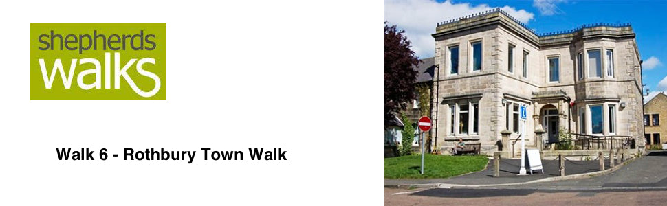
Bear right and cross the road to the home of Shepherds Walks. This was originally the church house, built in 1873.
Next to it is the original doorway and site of the famous ‘Three Half Moons’, where the ill fated Earl of Derwentwater and his men stayed a night before raising the standard for Bonnie Prince Charlie on his way to the 1715 Jacobite Rising and the executioners block. The inn, once the village courthouse and meeting place for all-important events, was demolished over a century ago.
As you continue on All Saints Church is the next building along. It is on the site of a much larger Saxon church. The Church was Victorionized and therefore mostly rebuilt in 1850. The only portion of the original thirteenth century building is the chancel, the east wall of the south transept and the lofty chancel arch. The base of the font is made from the foot of a Saxon cross.
As you continue down the road the ‘old church yard’ is on your right. Lord Armstrong of Cragside is buried here.
Follow the road around to your left and descend down Haw Hill. The Bunkhouse at the bottom on the left was built in 1841 as a boy’s school.
Cross over the road here and go down the path next to the bridge, to the wide riverbank. Bear right and walk along the Coquetdale River until you reach the footbridge. Cross this to return to the car park.