
Walk 36 - Edlingham to Alnwick - Moderate Route
Distance: 8 miles (12.8 km)
Maps: Explorer 332
Walking time: 4 hours
Start: Edlingham Road End (catch bus from Alnwick) then you will walk back to Alnwick (grid ref (Edlingham road end) - NU118088)
DOWLOAD a PDF of this walk with a map from here.
Summary
As this is a linear walk it is best to catch the Rothbury bus from Alnwick but get off at Edlingham, then you will walk back to Alnwick.
Edlingham Castle has its origins in a house built by John de Edlingham in the 12th century, which was subsequently strengthened and fortified over the next three centuries.
The walk leaves the castle and church behind and passes through some lovely farmland before rising up to and joining the old railway line.
From the old railway line you get stuning views over tp the Cheviot Hills. We then cross some open access ground and climb upto the 'golf ball' that sits high above Alnwick and can be seen from miles around.
Then we follow the wall of the Duke of Northumberlands Estate (Hulne Park) as we drop down into Alnwick.
We then join this lovely permissive route as we head towards Alnwick. It gives you a very bit outlook on this area.
On catching the bus from Alnwick to Rothbury at the start of the walk then you walk back to Alnwick
Route Details.
From Edlingham, Road End (the location where the bus drops you off) walk down the road towards Edlingham and take the first right towards the church (St John the Baptist) and turn left just in front of it (Public Footpath sign – Overthwarts 1 ¼, Lemmington Hall 1 ¾ ) and walk down a small path with the church away to your right.
St John the Baptist Church is a Medieval (11th century) church. The church is mostly Norman, from two periods, the late 11th - early 12th Century and late 12th century.
At the end of the path you pass through a small wooden gate and turn right, following the wall on your right and walk down and pass through a large gate, bear left and follow the fence on your left with a hedge the far side of it.
Away to your right is Edlingham Castle, which is a Grade I listed building that is managed by English Heritage. The ruins are mostly laid low though much of the solar tower still stands despite an impressive crack running several storeys down to ground level. The castle was more probably a fortified manor house typical of many medieval houses in this region.
As you continue on you pass two large gates before reaching the corner of the fence where it turns left through 90 degrees. You bear just 45 degrees here and head towards the stile in the top left corner of the field. After crossing the stile turn right and cross the old railway line to and through a small wooden gate that is located to the left of a large wooden gate (Public Footpath arrow on it).
Pass through the field following the field boundary on your right as you gradually drop down to a large wooden gate and pass through it.
From here you need to walk in the direction the Public Footpath arrow was pointing on the gatepost you just passed, which is away to the left. You are heading towards a telegraph pole on the far side of the field which is located in front of a wooded area (not the line of telegraph poles running away to your left).
Before you reach the telegraph pole you start to approach a fence line. At this point cast your eyes to your right and you can see a bridge crossing a small burn (the burn being lined by trees). This can be seen at the furthest point of the U shape in the field. When you see the point you are heading for bear right to the bridge passing through a small wooden gate to get to it and cross the bridge taking you over the Edlingham Burn.
After crossing the bridge continue walking in the same direction passing to the right of a row of trees and walk directly up the hill in front of you. As you climb up you start to see the top of a large tree just in front of a house and you head towards this. As you reach the brow of the hill you will see the large gate you are heading towards which is just to the right of the tree. Pass through the gate and turn right and follow the road with the houses on your left.
Continue to follow the road as it bears around to the left and after a short while you are walking along a hedge lined single track road leading away from the farm. As you continue along you reach a fence on your right and then the road bends around to the right then left before you reach the T-junction onto a road, with the old railway bridge away to your right.
Turn left here, walk 25 yards before turning right through a small wooden gate (Public Footpath sign – Broome Wood 1). Follow the trodden path through the wood, which is not great and rough underfoot in places but is fairly easy to navigate as you just need to run parallel to the fence away to your left.
After a little distance you reach and pass through a gate on your left hand side.
Pass through the gate into the field. Walk in the direction of the Public Footpath arrow on the gate that is pointing towards another gate which is taking you through the boundary on the right of the field, with the gate located about a 1/3 distance down the field. The gate you are heading for has a wooded area behind it.
As you cross the field you can see a monument. This is called the Fellbridge monument as it once stood in Fellbridge, Surrey. When it was in Surrey it was known as the Evelyn Monument and in the 1920’s it was brought to Northumberland.
As you reach the gate pass through it and walk through a wooded area and cross a small bridge taking you over the burn. Pass into the next field. You need to bear slightly to the right as you head towards the gate which is located to the far right of the fence line that passes through the far side of the field. This gate is where the fence meets the trees (the trees are actually the line of the old railway).
When you reach this large metal gate pass through it, turn left but instead of following the boundary on your left, walk out into the field passing between two prominent clumps of gorse bushes. As you reach the gorse bushes bear left heading towards a small cottage. Just as you pass the cottage you go through a gate and turn right along the drive which is taking you away from the cottage.
You then reach a road and turn right along it. Just be careful as you walk up the road, there is a wide verge you can walk on but even though it is a quiet country lane many cars use it as a short cut from Alnwick to Wooler.
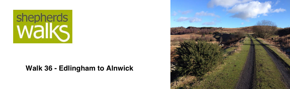
After a short time you pass over the old railway bridge and after a few hundred yards you need to pass through the gate taking you onto a track which takes you into a wood. The track drops down a little and you bear right along the bed of the old railway line.
After a few hundred yards you pass through a wooden gate as you continue along the railway line. Ignore the steps leading from the route and continue to follow the old railway line and the ground opens up to the left with some great views away to the North.
You then pass through another large gate taking you into a wooded section again and after a few hundred yards the railway you are following starts to go into a deep cutting. At this point (before the cutting begins) bear left out of the old railway bed and follow the path as it rises up passing through an old stone wall.
You are utilising open access here and as you rise up you bear left and walk through the rough ground with a boundary away on your right. As I said you are using open access here so there is no prominent path. As you are approaching the road you bear to your left a little and pass to and through a wooden gate (with a ‘Please close the gate’ sign on it).
Turn right along the road and pass Brizlee Wood entrance and just after that you pass through a small wooden gate on your left (‘Sorry no dogs’ sign on the gate).
Follow the wall on your left as you climb up towards the ’golf ball’ at the top.
As you climb you have some truly stunning views away to your left of the Cheviot Hills. In my years of walking I have looked at these hills from most angles (with it having such a prominent building on top it always catches your attention) but I have never actually climbed up to it before. It is so good to be walking up it and picking out all those locations that I have looked at from different angles.
You then reach the summit ‘golf ball’ which is the home to the Air Surveillance and Control System (ASACS) Force Command Type 93 Radar, the Radome was built in the 1990’s to protect the radar from the extremely harsh elements found up on the hill. Wind speeds of up to 100 knots have been experienced at Brizlee Wood as it is certainly exposed.
As you reach the tall wall at the top turn right and follow the wall so it is on your left. The wall is the boundary of Hulne Park.
Hulne Park is the only one remaining of the three parks that once surrounded Alnwick Castle in Northumberland. It provided wood and meat for the table of the Percy family, the Dukes of Northumberland.
As you drop down you pass through a small wooden gate (with a Public Footpath arrow on it) and continue walking in the same direction with the wall on your left. It can be a little muddy in places here so just negotiate it the best you can (I kept tight to the wall).
As you continue to follow the wall you pass through fields, wooded sections and over stiles and you enter the edge of Alnwick before dropping down to the road with the main entrance to Hulne Park on your left.
Don’t enter Hulne Park but instead turn right along the road.
As you reach the T-junction turn right and after a further 100 yards turn right up Northumberland Street and this takes you to the bus station next to Morrison’s supermarket.