
Walk 32 - Carriageway Drive - Above Rothbury - Moderate Route
Distance: 4 miles (6.4 km)
Maps: Explorer maps OL42 and 332
Walking time: 3 hours
Start: Rothbury. Cowhaugh car park (Grid ref - NU 057015). If you
enter Rothbury from Alnwick direction turn left along Bridge Street
(opposite Barclays Bank), cross the bridge and turn right.
The car park is on the right, next to the River Coquet.
DOWLOAD a PDF of this walk with a map from here.
Summary
This superb walk explores one of the prettiest areas in the Coquet Valley.
Initially the walk takes you north of Rothbury, with great views of the old race course before continuing up the old Carriageway Drive.
From here you get great views across the valley to the Simonside Hills.
A great walk. Strong shoes are essential and don’t forget your waterproofs.
Route Details.
From the car park cross the footbridge over the river Coquet, turn right and follow the river on your right. Continue on until you reach the road bridge.
Pass up the side of the bridge onto the road. Turn left along Bridge Street and walk down the street heading towards Barclays Bank.
At the T-junction turn left and walk up the main street with a row of shops up on your right.
King John gave Rothbury its charter as a market town when he visited it in 1205. For a couple of centuries the border reivers kept things lively in the valley with thousands of sheep, cattle and horses stolen from both sides of the border. In the early 19th century Rothbury was a poor two street affair, with mostly stone cottages and houses, thatched with heather from the surrounding hills. It had lots of public houses, several small shops and of course a Parish Church. All the roads were earth surfaced.
You pass Orchard House at the top end of village on the right.
Take the next road on your right (just before Catholic Church); ignore the footpaths going off to the right as you climb up the steep road.
As you rise up you are treated to some great views of the golf course away to your left.
The golf course is located on the flat ‘haugh’ ground that in the past was the location of the old Rothbury race course. They used to put a temporary bridge across the river to get all the horses and spectators across.
At the top of the hill turn right along ‘Hillside East’ and then take the first left along ‘Pennystone Lane’.
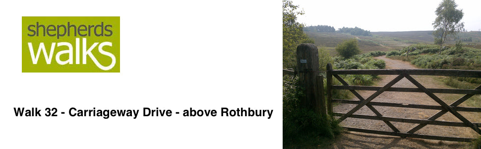
Follow the road as it bends around to the right and winds its way up and turns into a track before you reach and pass through a large wooden gate.
Continue along the track with a large wall initially on your left as you rise up before dropping down.
You pass a gate on your left (don’t go through it) on which there is a sign to ‘Gimmerknowe’ .
This surely has to be the best named cottage in Northumberland. Gimmer is a two year old sheep and knowe is a small hill. This therefore will be the paddock next to the shepherd’s cottage that the ‘first time lambers’ would be put in for lambing time enabling the shepherd to keep a close eye on them.
Continue along the track on which you were previously as it passes through a wooded section before rising up and passing a remote house on your left.
The track bends around to the right and you start to follow a wall on your left.
Stone walls are actually two separate walls held together with ‘through stones’ which tie the two walls together. The cavity formed is filled in with small stones and then capped off with ‘coping stones’ to make the whole wall weather tight.
Ignore the gate on your left but continue following the path as you lose the wall on your left.
After a little while you see a steep path going up to your right (just before a large tree), follow this up to the carriageway, which is a large track. If you miss the steep path don’t worry the path you are following eventually bears to the right and eventually joins the carriageway drive further up.
Once you reach the carriageway drive turn right along it.
Simonside can be seen on the opposite side of valley. The distinctive flat top is very easily recognisable and as it stands away from the true ‘Cheviots’ it is very well known in the walking world.
The Carriageway Drive is reasonably level as it was made for the horse and carriages era, it winds around so that it keeps to level ground.
As the track turns sharply to the left just before you reach a communication mast, bear right along the rough footpath, which leads to a stone cairn overlooking Rothbury. Here you are treated to some of the finest views of Rothbury.
The car park on the far side of the river (where your car is hopefully parked) can be easily picked out and all Saints Church can also be seen.
Continue to follow the rough path from the stone cairn, descending to the bottom corner of the wood. The path is well trodden but rather steep, so take care.
At the bottom, cross the stile (yellow public footpath marker) and follow the lane by the side of the houses on to the road.
Bear left along the road and follow it down to a T-junction. Turn right then immediately left down some steps (Public foopath sign - Rothbury ¼ mile) by the side of some houses. This path eventually turns into a road and you follow it down to the T-junction.
Turn left at the T-junction and follow the road around to your right. This brings you back on to the Rothbury main street with ‘Otterburn Mill’ on your right.
Turn left on to the main street and then first right.
Follow the road and pass down the right- hand side of the bridge then turn right before passing over the footbridge to the car park.
Revised Jan 2017