
Walk 23 - The Ingram Horseshoe - Moderate Route
Distance: 5 miles (8 km)
Maps: Explorer OL16 and Explorer 332
Walking time: 3 hours
Start and Finish point: National Park Bridge car park, Ingram (grid ref. NU 018163). From the A697, turn left approximately 1 mile north of Powburn (signed - Brandon 1, Ingram 3, Linhope 6). Follow this road for 3 miles before turning left into the National Park car park (immediately over the second bridge you cross).
DOWNLOAD a PDF of this walk from here.
Summary.
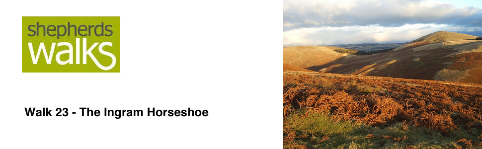
This wonderful walk explores some of the lower lying hills to the south of Ingram. These are packed full of Bronze Age burial cairns and settlements dating back to Iron Age and Roman times.
The walk involves some climbing, but you will be rewarded with some spectacular views of the Breamish Valley, the Simonside Hills and a sense of isolation, which is second to none.
The route is good underfoot, but strong shoes and waterproof clothing are recommended.
Route Details.
Leave the car park through the entrance you drove in through and turn left along the road. Pass the telephone box on your left, cross the road bridge and turn left (road sign - Ingram Mill 1⁄2).
Follow the lane and just before the village hall turn right through a large gate onto a broad track (signposted – Prendwick 2 3⁄4).
Walk up the broad track with a fence on your left. As you walk up you can see another fence going off to your left at 90 degrees. Along its line is an overgrown hawthorn hedge.
Originally hedges like this were planted to create stock proof boundaries, but if not managed correctly they grow into tall, broken lines of bushes. As the hedge grows it should be ‘laid’ to make it stock proof. This is done by taking a small cut out of the bottom of each plant and ‘lying it down’, so that it runs parallel to the ground. Any new shoots will grow up to form a dense field boundary.
Continue up the track until you reach a stile located to the left of a gate. Cross the stile and follow the track as it bends firstly to your right and then to the left.
As you walk, look out for small piles of stones on your left. These stones will have been ‘picked’ from the field on your right in order to avoid damage to agricultural machinery. During cultivation stones are brought to the surface.
These must be either physically removed from the ground or rolled back into the earth with a roller trailed behind a tractor. If this is not done the ‘drill’, which sows the seed, gets damaged and if the field ever is mowed for either silage or hay the mower blades will be broken on the protruding stones.
Pass through the large gate at the top of the track and follow the track out on to the open hill. Down to your left is Fawdon Dean. Pass over the next stile, which has a large gate to the right of it and continue straight ahead.
On your right is the Iron Age hill fort on Wether Hill. Archaeologists have discovered that two phases of settlement existed on this site before the hill fort was built around 250 BC. Shallow circles in the ground are all that remains of the timber roundhouses that once stood within. To the north east of the hill fort, a timber cist or coffin was found dating back to the Bronze Age, around 2000 BC. Numerous other settlements and burial sites lie within the neighbourhood.
Continue on the track ahead of you, ignoring the hill fort trail marker post off to your right. As the track rises up you get a wonderful view of the ‘flat topped’ Simonside Hills close to the lovely market town of Rothbury. The Simonside Hills rise up to 1500 feet above sea level.
Next, watch out for a path which turns left off the main track which is 50 metres before a small sign at floor level – a ‘permissive path’ which is itself approximately 120 metres before a gate leading into a field. (If you get to this sign backtrack for 50m as this original track is now overgrown.) Turn left on to the path and down into a small valley. Follow the prominent path that crosses the valley floor and leads to a small wooden gate.
Pass through the gate and climb steeply on the clear path with bracken either side of you.
When you reach the marker post at the top bear right, following the permissive footpath arrow on it. After a few yards turn right through 90 degrees and pass down to a small marker post. Next, turn left on to the public footpath which winds around the side of the hill.
Continue along the path, passing a marker post, as you continue to run parallel to the fence on your right before it bears away. You are heading for the bottom edge of the plantation located in front of you. As you approach the plantation you will see the triangulation point located on the top of Old Fawdon Hill.
On the summit of Old Fawdon Hill lie the remains of another Iron Age hill fort. At least 34 roundhouses have been recorded within the ramparts, surviving either as level platforms or low stone foundations.
Triangulation points were used to map the country. Distances and heights could be measured using three known points all of which were visible from each other (hence triangulation). The original Ordnance Survey was done for military purposes and in the early 1800’s a triangulation point was established on the Cheviot summit. Sadly, with the advent of the Global Positioning Satellite network ‘trig’ points (as they are now known) have become redundant.
Pass to the right of the plantation and notice how the ground has become eroded around its edge. This is caused by cattle sheltering from wind and rain. The ground has become so damaged that fence posts have become loose. A single strand of barbed wire has been put up to keep the cattle away from the main fence, thereby preventing further damage. This ‘barb guard’ is a far cheaper option than renewing the whole of the main fence.
In the ‘V’ of the wood is a small shed. In the past this would have been used to hold feed for stock over the winter. Only very few of these buildings are now used; most are redundant. Today, the advent of the quad motorcycle, with its low-pressure wide tyres, enables farmers to reach and feed stock even on the poorest terrain.
From this point the path becomes a little less visible underfoot, but you have a field on your right and the ground rising up to Old Fawdon Hill on your left. The path joins a rutted track, running along the top of the grass field on your right.
The sheep that you may see are Swaledale and Blackface sheep. These two very popular hill breeds manage to graze on this poorer ground.
The Swaledales have a slightly narrower face with white patches around each eye. The Blackface sheep have a wider face and a slightly larger body.
The track passes a plantation on your right and joins a larger, more worn farm track. Bear left along it and continue with the fence on your right.
After a few hundred yards (just before the track bears off to the left) turn right and pass down to a stile, situated next to a gate. Cross the stile into the field.
Bear left across the field, heading for the gate located about a third of the way up the fence line separating the two fields ahead of you. You are walking in the direction of the farm in the distance, with the two peaks of Gibb’s Hill and Castle Knowe on your right.
Castle Knowe had a camp standing on its rocky summit. This Iron Age settlement was surrounded by three oval ramparts. No remains of occupation have been found within the enclosure. This is also a Scheduled Ancient Monument.
Cross the Fawdon Burn just before the next gate. Pass through the gate and walk straight across the next field.
Down to your right you can see some sheep handling pens, with a small shed located next to them. There are often buzzards circling in the updrafts in this area.
You next approach two gates situated next to each other. Pass through the left-hand one and continue along the path which runs alongside a fence and an overgrown hawthorn hedge. Follow this boundary as it passes through 90 degrees to the right. As you reach a gate in the fence on your right you bear left across the field. Follow the path, heading for the gate located just to the right of a plantation on the far side.
Pass through the gate and continue along the track, following the fence on your right with a hawthorn hedge on the far side of it. You pass to the left of a large corrugated tin building which would be used to house newly calved cattle out of the field which it opens in to.
On the right you are now following a wall. This is unusual, as it is a ‘wet stone wall’ rather than a ‘dry’ one. This means that it has been built using mortar. There are a number of reasons for this. Firstly you are higher than the field on the far side of it; therefore it is also a retaining wall. Also as it is the boundary for the ‘close’ it will get a lot of stock pressure on it. This small ‘close’ will be used when you have a freshly calved cow or something similar that needs a watchful eye. Therefore the wall will get a lot of stock pressure on it; the mortar adds to its strength.
Continue along the track, passing the bungalow on your right. Pass through the gate and turn left (Public Footpath – Brandon 1). Follow the prominent path as it rises up and then winds its way down to a large gate. At the time of writing the catch that the gate-bolt goes into is made out of an old bearing housing. This is certainly using your initiative!
Pass through the gate and continue along the track which takes you through the field before crossing the Fawden Burn and passing through a large gate. Turn left on to the tarmac road.
Pass Ingram Village Hall on your right, go through the adjacent gate and then turn right along the road, passing the church, St Michael and All Angels on your left.
St Michael’s Church serves Ingram parish. Though part of the tower is thought to date from the 11th century AD, the church has been renovated on several occasions and was almost completely rebuilt in the late 19th century.
Continue down the road into the car park for the National Park Visitor Centre, which was originally the village school. Turn left from the car park into the woodland and follow this lovely woodland path with the river Breamish on your right.
The path brings you out on to the car park from where you started the walk.