
Walk 10 - Windy Gyle - Difficult Route
Distance: 11 miles (18 km)
Maps: Explorer OL16
Walking time: 5 hour
Start and Finish point: Half a mile past Barrow Burn, in the Coquetdale valley. Take the B6341 out of Rothbury and bear right at Flotterton. Continue along this road passing through Harbottle and Alwinton. Continue on, pass through Barrow Burn and half a mile later there is a small area to park on, next to a road bridge, where the Coquet and the Rowhope burn meet and a small track goes off to the right (Grid reference NT 860115).
DOWNLOAD the self led walking guide for Windy Gyle from here
Summary
This is my all time favourite walk in Northumberland. I never get tired of walking Windy Gyle. Apart from the Cheviot itself it must be one of the best-known summits in Northumberland but luckily its relative isolation seems to keep a lot of people away.
This wonderful route follows ‘The Street’, an old drovers’ road to the border fence between England and Scotland. You follow the border fence and then cross over into Scotland to reach the summit of Windy Gyle. You keep your height here for a while following the Pennine Way and the border fence. You descend down ‘Clennell Street’, another drovers’ road that has been worn away over many centuries.
If you only do one walk in Northumberland this should be it. The walk follows good clear paths throughout but strong shoes and waterproofs are essential.
Route Details
From the parking area cross over the road bridge taking you over the Rowhope Burn.
Immediately after the bridge turn right off the road and walk to and cross the stile located to the right of a large gate (signpost, The Street, Border Ridge 3). After crossing the stile turn left and follow the clear path up the spine of the ridge, following the fence on your left as you climb up steeply.
The land you are on, north of the river Coquet, is part of a military training area but the way-marked paths can be used at all times. Soldiers train here but only use blank ammunition. There is no live firing.
As the path levels out ignore the stile to your left, but instead stay to the right of the fence continuing on for a further 50 yards as you rise up to the stile which is located to the right of a large metal gate. Cross the stile and follow the fence on your left and continue. After a little while the fence bends through 90 degrees to the right before rising up to a stile and gate (bridleway marker on gate). Cross the stile.
You are now on the left of the fence as you continue to follow the fence. Even though you are reasonably high up there are still a lot of fences rising up to the fence you are following. These fences running down the side of the mountain will make up the ‘in-bye’ ground for the farms located in the valley below. The ‘in-bye’ land will be used to hold sheep during lambing, shearing and when the rams are out with the ewes.
As you continue on you pass a bridleway marker post and continue following the fence on your right, ignoring the stile also on your right, Continue straight on heading for the stile located to the right of a large metal gate just below the hilltop.
Go over the stile and then fork right after about 50 yards (45m), so that you pass to the right of the hilltop keeping to the track.
On your right down in the bottom of the valley you can see some sheep handling pens. In the past it was common practice to locate your pens next to a watercourse so that you could pump or divert the water from the burn in to your sheep dip. Since the health risk to humans caused by dip has become apparent and the bad effect of used dip on aqua life, it is now illegal to dip near any watercourses.
Continue on following the prominent path that is running parallel to the fence on your right. After a little while you pass a bridleway marker post located directly opposite a metal gate. Don’t go through the gate, but continue to follow the fence on your right until you reach and cross a stile (bridleway marker on it), situated to the side of a large metal gate.
Keep to the main track with the ground rising up on your left to the summit of Swineside Law. Continue on, passing a stile on your right as you follow the fence, also on your right, as you gradually rise.
The track then drops down on a clear track as you continue along ‘The Street’.
‘The Street’ is the name given to the clear track leading from Barrow Burn over Black Braes and the main ridge of the Cheviot, which is crossed near Monzie Law, and down to Hownam in the valley of Kale water. It was an old drovers’ road used by both packhorse trains and also for moving livestock to the English markets. Although traffic eased on these drovers’ roads during the period of medieval border warfare, it became firmly re-established in the 17th and 18th centuries, particularly by drovers keen to avoid the tolls of the new turnpike roads.
You eventually drop down and reach a stile (bridleway marker on it). After crossing it you follow the track, running parallel to a fence on your left as you climb up to the horizon, passing a bridleway marker post also on your left.
You rise up to and cross a stile (bridleway marker), located to the right of a large wooden gate. Keep to the main track running parallel to the fence on your right.
Keep your eyes open in this vicinity for the wild goats. A herd of elusive wild goats live in the Cheviot Hills. The herd is descended from domestic stock put out into the hills to graze by farmers centuries ago. You can often catch sight of these small black goats on this section of the walk.
Continue along the broad path, with the ground dropping off steeply to your left and ignore the stile up to your right.
Cross the next stile, this is next to a gate. Here you get a lovely view of Windy Gyle away to your right with its cairn on top. It looks magnificent!
Continue on the broad prominent path leading away from the gate, following the fence on your left.
At the four-way signpost turn right (Bridleway - Pennine Way, Windy Gyle 1 ½).
This path cuts the corner off and you soon reach the border fence. Keep to the right of the fence (English side of border), sticking to the track as you rise up on to Windy Rigg.
After passing over Windy Rigg the path drops down a little, passing two small gates on your left. Don’t pass through them but continue to follow the fence on your left.
As you start your ascent of Windy Gyle cross over the fence at the stile, taking you into Scotland. You now follow the fence on your right, before just bending away from it as you climb to the summit.
Windy Gyle is 2010 feet (619 m) above sea level. Therefore it exceeds the magical 2000 feet barrier, this is usually the point that hills finish and mountains begin.
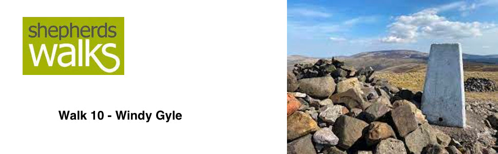
The massive cairn on the summit is called ‘Russell’s Cairn’. This is a Bronze Age mound but it was named after Lord Francis Russell who was killed in the border battles in the area, probably at Hexpethgate where Clennell Street crosses the border ridge; on 27th July 1585. This was the day of the truce. It was the day that the English and Scottish met together at selected points along the border to air their grievances and right their wrongs.
From the summit walk towards the Border Fence (signpost – Trows 2, Rowhope 2 ¼, Coquet Valley 2 ¾). Cross the stile and turn left immediately and follow the fence on your left hand side.
On this stretch of the route Northumberland National Park has built small bridges across some of the eroded ground. This has very much improved the path you are following. On the opposite side of the fence (the Scottish side) is the course of the Pennine Way.
The Pennine Way was the first U.K. Long Distance Path (now National Trail) and was officially opened in 1965. Its original theme was the provision of the opportunity to make long distance journeys through predominantly wild country.
In 1989 the Pennine Way was 502km (314 miles) in total, including loops. By 1994 rationalisation of some of the misalignments had reduced this to 463km (288 miles). It runs between Edale in Derbyshire and Kirk Yetholm in the Scottish borders taking in Northern England's finest moorland scenery.
Just as you drop down the path you are following has been paved to stop erosion. Cross the stile and continue on following the fence on your left until you reach the four-way signpost.
Turn right here, off the Pennine Way, on to Clennell Street (signpost - Clennell Street, Alwinton 9, Uswayford 1 ½).
This old road runs from Alwinton to Cocklawfoot in the valley of the Bowmont Water, on the Scottish side of the border. This ancient route has been traced back to prehistoric times but used more recently by smugglers.
At the fork in the track bear right (signpost - Clennell Street, Usway 1 ½, Alwinton 8) and pass through the large gate.
At the next signpost follow the path round to the right (do not go into the woods) and continue on for a while, with forests either side of you.
The foliage you are walking through is very typical of the Cheviots. This white ‘straw like’ grass is very different from that of many of the other upland areas, which are usually covered in heather. Therefore it is ‘kinder’ to sheep. This is one of the reasons that the hill sheep in Northumberland are slightly larger than those in other mountainous areas in the country. Breeds like the Cheviot, a large bodied white-faced sheep and the ‘Northumbrian’ Blackface have therefore evolved in this area. These breeds of sheep are larger than the traditional ‘Scottish’ Blackface and Swaledale sheep that are found on heather clad high ground.
You continue along the prominent path with the ground rising up to Hazely Law on your left and a forest on your right. The path winds its way down as you descend to a rough farm road (this leads to the remote hill farm of Uswayford).
Cross the road (signpost – Clennell Street, Public Bridleway, Alwinton 6 ½). After about 70 yards you reach a small gate, with a stile to its left. Do not pass through the gate, but bear right in front of it, as this is where we leave Clennell Street. Instead pass to the right of the hut, following the fence on your left and cross the stile (bridleway marker) with the large gate located next to it.
Go over the spine of the hill ahead, with steep slopes falling away to each side and cross the ladder stile situated to the left of a large gate, taking you into the forest.
In the forest you rise up to the fork, with a marker post situated away to your left. Bear right here and stick to the track as you gradually rise up. The path then drops down to a bridleway marker post pointing left into the woods.
Follow the path for about 25 yards then you turn right along another forest track and rise up to the ladder stile, situated to the left of a large gate. Cross the stile, taking you out of the forest and continue on the prominent path.
The Usway Burn is down to your left. Looking down on the ruined walls of the old handling pens and stell you can imagine the thriving farming community in years gone by before both the forest was planted and these small hill farms became uneconomic.
Stick to the main track with the ground rising up to your left as you slowly descend to the burn on your right, before rising slightly following the fence on your right and dropping down to the stile and gate located just before the buildings. Go over the stile (bridleway marker on it), pass the buildings on your right and follow the road, crossing a cattle grid and continue on as it passes through 90 degrees to your right. As you drop down you pass a bridleway marker post and cross the cattle grid just before you reach the ford, with a footbridge a little way downstream.
Cross the footbridge and turn right, passing the buildings on your left and bear left at the white marker post (bridleway arrow on it) along a green track to the gate (bridleway marker on it). Pass through the gate on to the road and bear right along it.
Continue up the road, with the river Coquet on your left.
On your right you pass some sheep handling pens. You can see on the far side of them a ‘sheep race’. This narrow passage is used both to hold the sheep in for worming etc and also you can see small gates which open up into the race. These will be used to shed sheep or lambs into the side pens. This is useful when you need to draw lambs or a particular age of sheep from the main flock so that you can work with them separately.
Continue along the road and you reach your car on the right.
Revised June 2004