Self led walking guides - Northumberland - FREE downloads RSS
Walk 28 - Linear - Carriageway Drive - Moderate Route


Distance: 4.5 miles (7.2 km)
Maps: Explorer maps OL42 and 332
Walking time: 2 hours
Start: Thropton – Local Bus stop (grid ref - NU031021).
Finish: Rothbury – Local Bus stop.
Maps: Explorer maps OL42 and 332
Walking time: 2 hours
Start: Thropton – Local Bus stop (grid ref - NU031021).
Finish: Rothbury – Local Bus stop.
Walk 29 - St Cuthbert's Way Circular - Moderate route
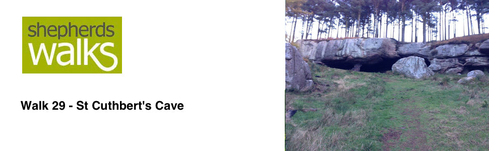

Distance: 4.5 miles (7.2 km)
Maps: Explorer Map 340
Walking time: 2 1⁄2 hours
Start: St Cuthbert’s Cave Car Park (grid ref - NU051351)
Walk 30 - Alnwick Pastures - Easy Route


Distance: 3.5 miles (5.6 km)
Maps: Explorer map 332
Walking time: 1 1⁄2 hours
Start: Alnwick Market Place (grid ref - NU186133)
Maps: Explorer map 332
Walking time: 1 1⁄2 hours
Start: Alnwick Market Place (grid ref - NU186133)
Walk 31 - Budle Bay - Moderate Route
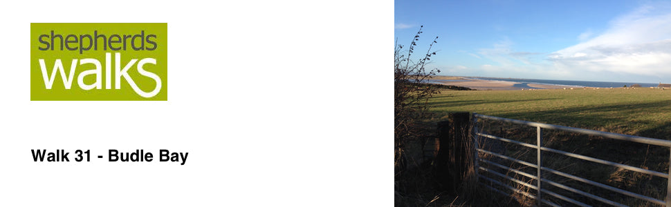

Distance: 3.5 miles (5.6 km)
Maps: Explorer Map 340
Walking time: 2 hours
Start: Budle Bay, Bamburgh
Maps: Explorer Map 340
Walking time: 2 hours
Start: Budle Bay, Bamburgh
Walk 32 - Carriageway Drive - Above Rothbury - Moderate Route
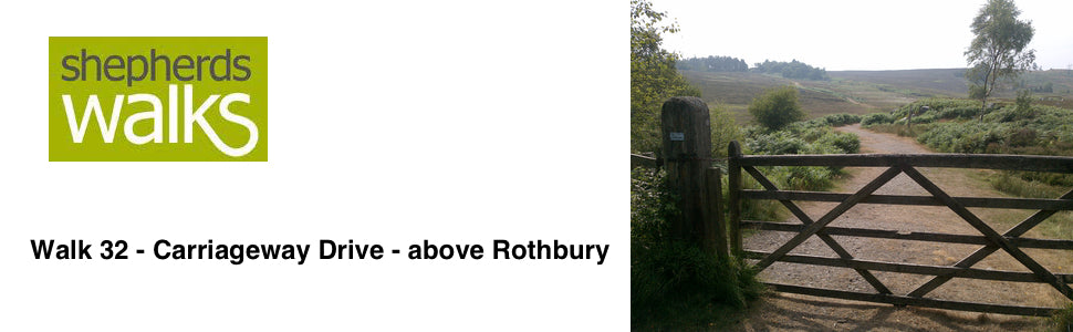

Distance: 4 miles (6.4 km)
Maps: Explorer maps OL42 and 332
Walking time: 3 hours
Start: Rothbury. Cowhaugh car park
Tags
- All
- Alnwick
- Alwinton
- Amble
- Barrowburn
- Beach
- Bellingham
- Bolam Lake
- Broadstruther
- Budle Bay
- Cambo
- Carey Burn
- Carriageway Drive
- Cheviot
- Cheviot Hills
- College Valley
- Coquetdale
- Dunstanburgh Castle
- Edlingham
- Fontburn
- free
- Hadrians Wall
- Happy Valley
- Harbottle
- Hareshaw Linn
- Hartburn
- Harwood
- Hauxley
- Hexham
- Ingram
- Kielder
- Lemmington
- linear walk
- Lordenshaws
- Mitford Castle
- Morpeth
- Mtford
- Northumberland
- Northumberland Coast Path
- Northumberland Walking
- Pastures
- Rothbury
- Rothbury Trenches
- Shaftoe Crags
- Shepherds Walks
- Simonside
- St Cuthbert's Cave
- The Cheviot
- The Schil
- Town Walk
- Usway Burn
- Uswayford
- walking guide
- Wallington
- Warkworth
- West Dipton Burn
- Whitton Hillhead
- Windy Gyle