
Four Hillforts of the Coquet Valley - 2021
It had been a wet day the day before, but thankfully today looked a lot brighter.
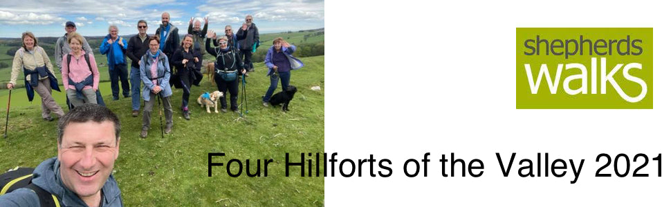
After meeting in Rothbury we headed to the first hillfort, Old Rothbury Hillfort.
Old Rothbury Hillfort is situated west of Rothbury on the northside of the valley and sits close to West Hills camp.
It has a double ring fortification though in places only a single ring is visible and there are traces of hut circles inside the enclosure.
It always seems a bit odd to find a hillfort half-way up a hill. You'd think it would have been too easy for attackers to lob missiles down from above.
But, the inhabitants of Rothbury must have had their reasons I suppose. The fort is on a nicely situated plateau, and there are traces of hut circles. They went to a bit of effort to build the double ditch and rampart system, though in some places there's just a single bank and ditch, as the natural slope is pretty steep.
After visiting this the first hillforts we headed off down Physic Lane and then made a quick detour off the lane to the second hillfort, West Hills Camp.
The site of West Hills Camp covers about 3 acres. This Iron Age hillfort is located on a spur overlooking a valley located to the south. The earthworks are well-preserved in their eastern and northern part where three lines of ramparts can be distinguished. There is a wide berm between two innermost ramparts.
It has never been excavated, although earlier field reports mention remains of hut circles, nowadays difficult to distinguish. East of the hillfort there are bedrock outcrops with Neolithic/Bronze Age rock art.
We then continued down Physic Lane to Thropton, after passing through the village before crossing the River Coquet. After passing across the valley bottom we continued up past Tosson Lime Kilm to Tosson Burgh Hillfort.
Tosson Burgh Hillfort occupies a very dramatic location, it is visible from miles away (even from Rothbury). It occupies a carefully chosen naturally defended site overlooking the Coquet valley to the north, west and east. Though there are no traces of habitation within the ramparts, the fort is unexcavated, and such features may survive below ground level.
The strong situation of Tosson Burgh hillfort suggests that it was intended for use as a fortification, though a public display of power and status may have been equally important.
Though evidence of habitation may yet be found inside the rampart, the fort is not large in area, in common with many other hillforts in Northumberland, and is unlikely to have supported any sizeable population. Smaller hillforts may have served as defended farmsteads established by autonomous small groups, rather than proto-urban centres.
After visiting this hill fort we continued to climb up to and over the Simonside Hills before dropping down to Lordenshaws Iron Age Hillfort.
Lordenshaw Hillfort comprises 3 ramparts separated by ditches and a counterscarp bank with a 2 metres high inner bank. Within the hillfort there are the remains of Iron Age hut circles. There are two entrances to the site, one to the east and one to the west. There are many rock art sites close by the hillfort.
It is a truly striking Iron Age hillfort.
From here we then dropped back down to Rothbury, a great walk with great company.
Jon - May 2021
View all the guided walks we have coming up in Northumberland.